Data Collection
This page describes the data collection procedure for all the modules. We used DJI Mavic Mini for conducting the research experiments. The specifications of the UAV can be found at the official website .
Distance Between Adjacent Buildings
For estimating the distance between adjacent structures, the images are collected in 3 different modes: Frontal Mode, In-Between Mode and Roof Mode.
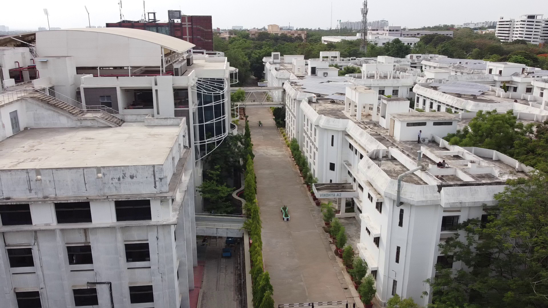
Fig. 1 Frontal Mode |
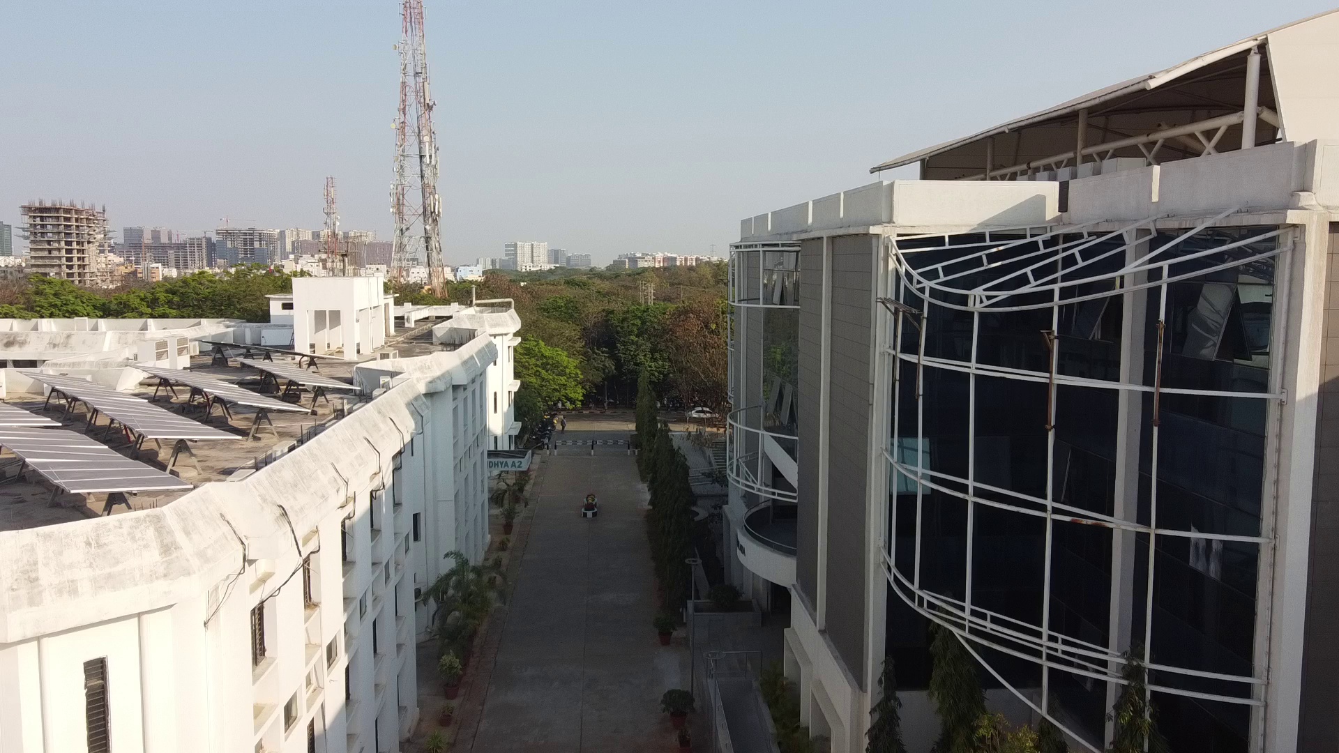
Fig. 2 In-Between Mode |
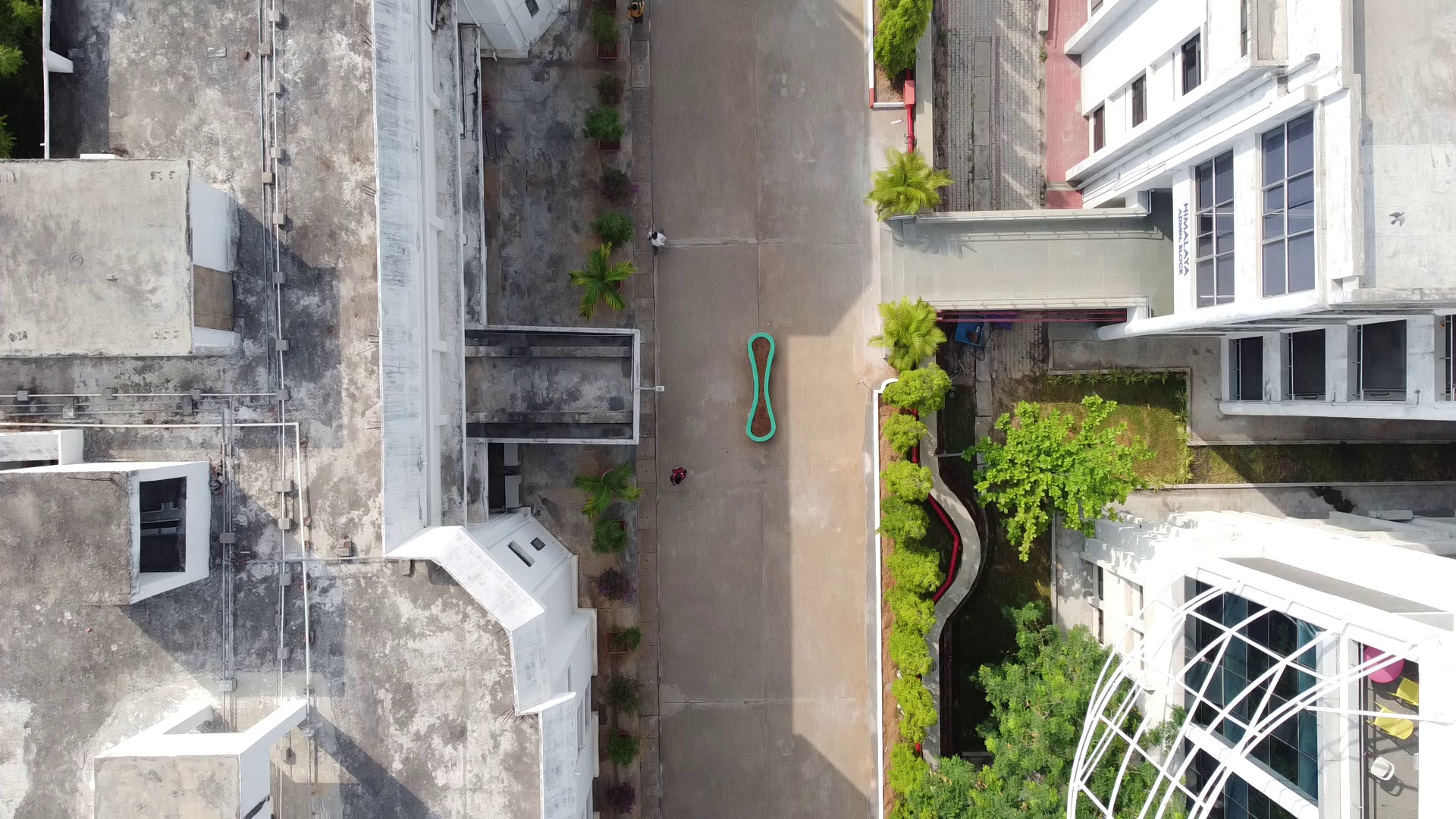
Fig. 3 Roof Mode |
Frontal Mode
Fig. 1 Shows the frontal face of two adjacent buildings for which data was collected. In this mode, we focused on estimating the distance between the two buildings by analyzing only their frontal faces while flying a UAV with a forward-facing camera. This view is particularly helpful when there are impediments between the subject buildings and flying a UAV between them is challenging.
The video describes the workflow of data collection for Frontal Mode. The UAV was operated with a forward facing camera.
In-Between Mode
Fig. 2 Shows that the UAV’s point-of-view for the In-between Mode. The UAV is navigated in between the subject buildings along a path parallel to the facade with a forward-facing camera. This mode enables the operators to calculate distances when the subject buildings have irregular shapes.
The video describes the workflow of data collection for In-Between Mode.
Roof Mode
Fig. 3 Shows the UAV’s point-of-view for the Roof Mode. The UAV was navigated at a fixed altitude with a downward-facing camera so as to capture the rooftops of the subject buildings. The roof mode helps in tackling occlusions due to vegetation and other physical structures.
The video describes the workflow of data collection for Roof Mode.
Plan Shape and Roof Area Estimation
For estimating the plan shape and roof area, the UAV was flown with a downward-facing camera over the roof at constant height. Our algorithm accounts for both orthoginal and non-orthogonal views of the roof.
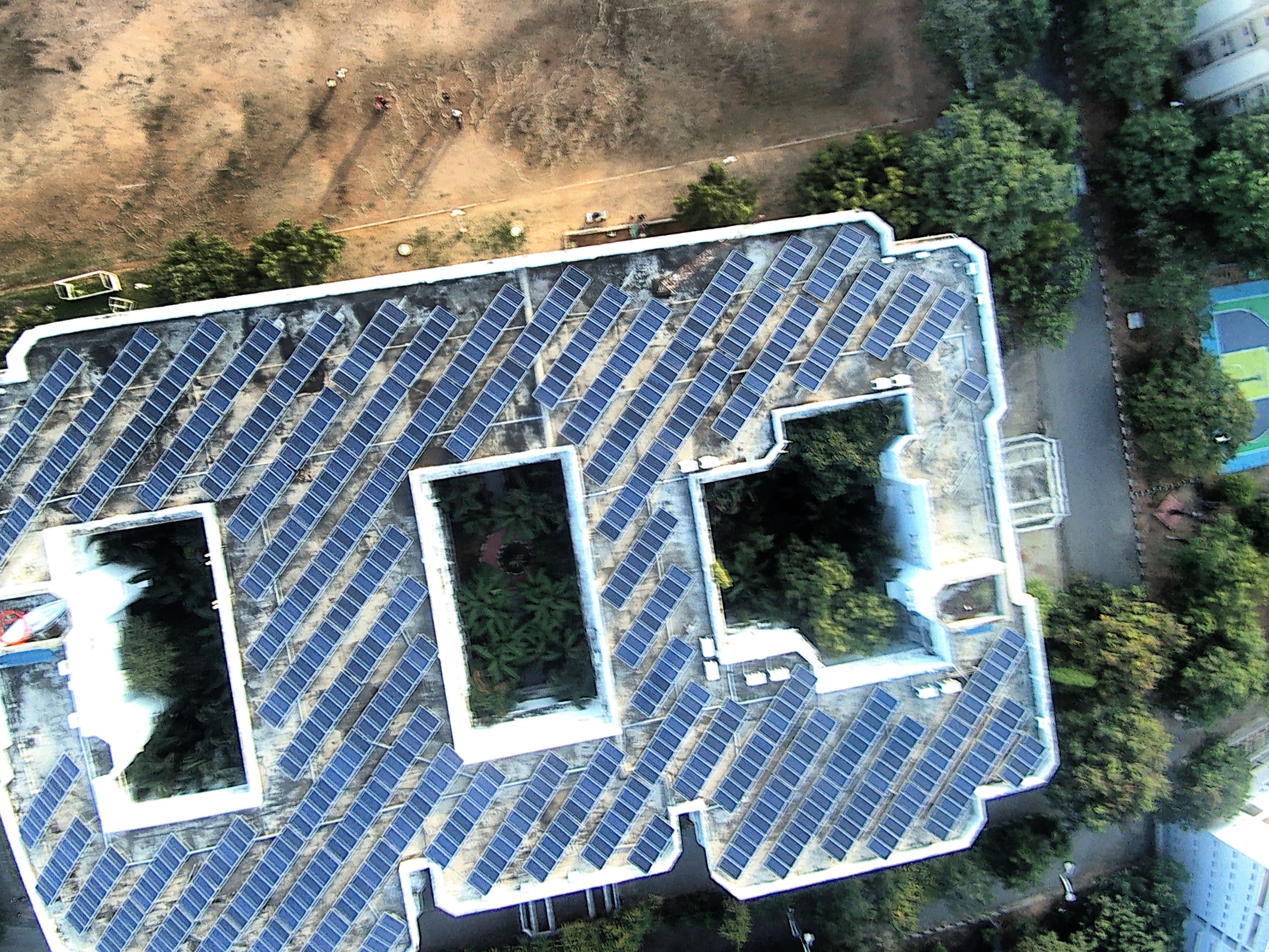
Fig. 4 Data Collection for Plan Shape and Roof Area Estimation
Roof Layout Estimation
For estimating the roof layout, the UAV was flown with a downward-facing camera over the roof at constant height.
Data Collection for Roof Layout Estimation